What is Airborne Lidar Bathymetry? A Comprehensive Overview
Airborne lidar bathymetry, a cutting-edge technology that combines light detection and ranging (lidar) with bathymetric principles, has become an invaluable tool for mapping underwater topography. This article delves into the significance and applications of airborne lidar bathymetry and explores its advantages, limitations, and future developments.
Lidar Technology: The Basics
Definition and Principles of Lidar
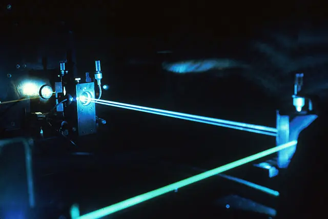
Lidar, an acronym for Light Detection and Ranging, is a remote sensing method that measures distances using laser light. By emitting laser pulses and measuring the time it takes for them to bounce back to the sensor, lidar creates detailed, accurate maps of the Earth’s surface. These maps provide valuable insights in various fields, including geology, forestry, and urban planning.
Components of a Lidar System
A typical lidar system consists of several crucial components:
- Laser transmitter: emits laser pulses toward the target
- Receiver and detectors: capture the reflected light and measure the time it takes for the light to return
- Position and navigation systems: determine the precise location and orientation of the lidar system during data acquisition
- Data acquisition and processing: convert raw data into accurate, usable maps
Bathymetry: Measuring the Depths of Bodies of Water
Importance of Understanding Underwater Topography
Comprehending underwater topography is vital for several reasons, including navigation safety, habitat mapping and conservation, and coastal management and planning. Accurate bathymetric data is essential for creating nautical charts, identifying suitable locations for infrastructure development, and monitoring coastal ecosystems.
Traditional Bathymetric Methods
Traditional bathymetric methods include:
- Echo sounding: measures water depth using sound waves
- Multibeam sonar: uses multiple beams of sound to map larger areas
- Satellite altimetry: estimates sea floor topography by measuring sea surface height variations
Airborne Lidar Bathymetry: How it Works
The Integration of Lidar and Bathymetry
Airborne lidar bathymetry integrates lidar technology with bathymetric principles to map underwater topography from an airborne platform. This approach allows for efficient and rapid data collection over large areas, particularly in shallow waters and coastal regions.
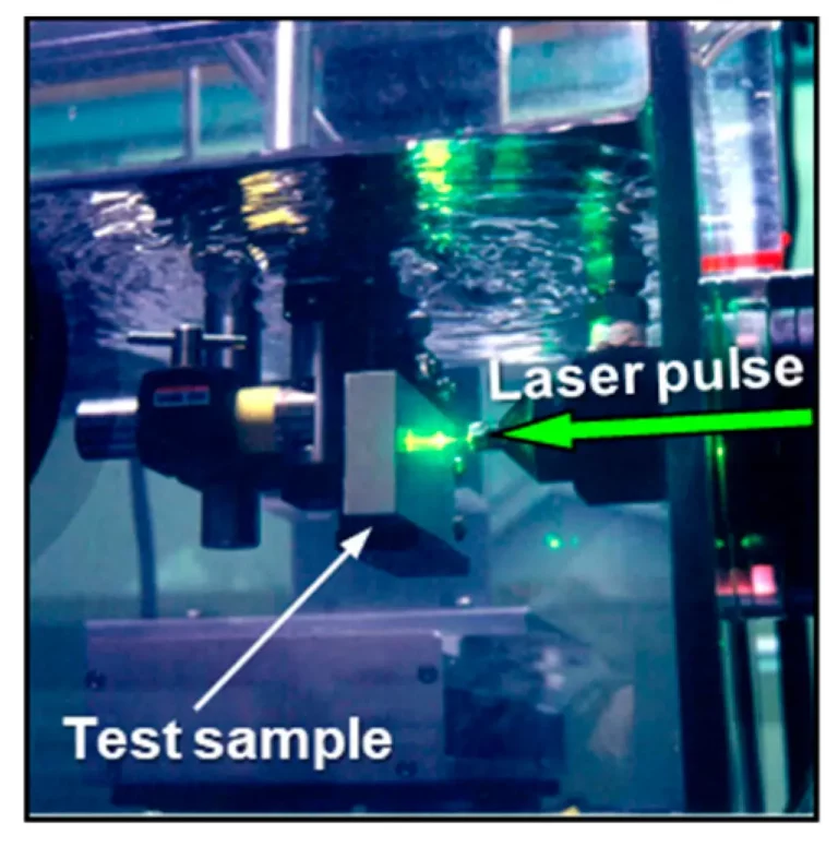
Green Laser Light and Water Penetration
Airborne lidar bathymetry systems employ green laser light (typically 532 nm), which penetrates water more effectively than other wavelengths. This feature enables the system to measure both the water surface and the submerged terrain.
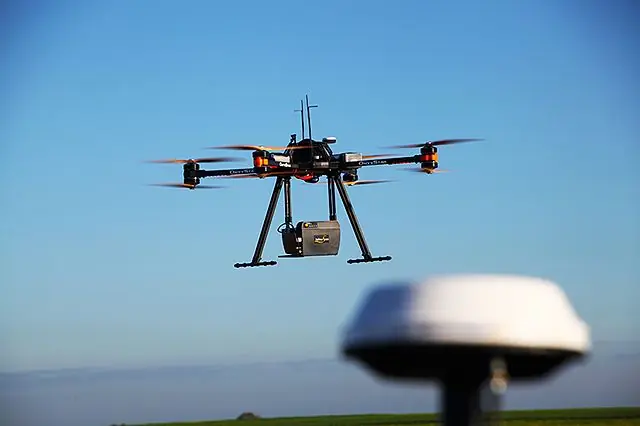
System Components Unique to Airborne Lidar Bathymetry
In addition to the standard lidar components, airborne lidar bathymetry systems incorporate:
- Airborne platform: typically an airplane or helicopter
- Specialized laser and detectors: designed for water penetration and measuring depths
- Waveform processing: required to separate surface and submerged returns
Advantages and Limitations of Airborne Lidar Bathymetry
Advantages of Airborne Lidar Bathymetry
Airborne lidar bathymetry offers several advantages over traditional bathymetric methods:
- Rapid data collection: covers large areas quickly and efficiently
- Large coverage area: suitable for mapping extensive coastal regions
- Ability to map shallow and coastal areas: particularly effective in these environments
- Cost-effective: less expensive than ship-based methods, especially for large-scale projects
- Minimal environmental impact: non-invasive and non-destructive data collection
Limitations of Airborne Lidar Bathymetry
Despite its numerous advantages, airborne lidar bathymetry has some limitations:
- Limited depth penetration: typically effective in depths up to 50 meters, depending on water clarity
- Water clarity requirements: less effective in turbid or murky waters
- Weather and sea conditions constraints: dependent on suitable weather and calm sea conditions for optimal data acquisition
- Data post-processing complexities: requires specialized software and expertise to process and analyze collected data
Applications of Airborne Lidar Bathymetry

Airborne lidar bathymetry has a wide range of applications, including:
Coastal Zone Management
- Erosion and sedimentation monitoring
- Shoreline mapping
Nautical Charting and Navigation
Accurate underwater topography for safe navigation and planning
Infrastructure Planning and Management
- Ports and harbors
- Offshore installations
- Submerged pipelines and cables
Environmental and Habitat Assessments
- Seagrass and coral reef mapping
- Benthic habitat classification
Disaster Response and Recovery
- Post-storm assessments
- Tsunami modeling and mapping
Future Developments and Trends in Airborne Lidar Bathymetry
As technology advances, airborne lidar bathymetry continues to evolve:
Advancements in Laser and Sensor Technology
Improved lasers and detectors will increase the depth penetration capabilities and accuracy of airborne lidar bathymetry systems.
Integration with Other Remote Sensing Technologies
Combining airborne lidar bathymetry with other remote sensing methods, such as hyperspectral imaging and synthetic aperture radar, will provide more comprehensive and detailed data.
Automation and Artificial Intelligence in Data Processing
Advanced algorithms and machine learning techniques will streamline data processing, reducing the need for manual intervention and minimizing errors.
Expanding Applications in Oceanography, Archaeology, and Climate Research
As the technology becomes more advanced and accessible, airborne lidar bathymetry will find new applications in various research fields, contributing to a deeper understanding of the world’s oceans and coastal environments.
Conclusion
Airborne lidar bathymetry has emerged as a powerful tool for mapping underwater topography, providing rapid, accurate, and cost-effective data collection over large areas. Despite some limitations, the technology has proven invaluable in numerous applications, from coastal zone management to disaster response. With ongoing advancements and a growing demand for accurate underwater mapping, airborne lidar bathymetry is poised to play an increasingly important role in understanding and protecting our planet’s coastal and marine ecosystems.